 |
Click on an airport to see a satellite view from Google maps.
Flight Planning Tool
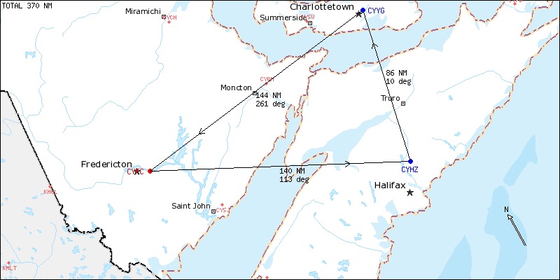
This Flight Planning Tool shows distance and direction between various airports. Most Canadian airports can be entered, as well as major US airports. Map data covers Canada and the northern US states.
| NOT FOR NAVIGATION --- Distances in NM | CYFC | CYHZ | CYYG | |
| FREDERICTON INTL (NB) | CYFC | - | 140 | 144 |
| HALIFAX STANFIELD INTL (NS) | CYHZ | 140 | - | 86 |
| CHARLOTTETOWN (PE) | CYYG | 144 | 86 | - |
The map below shows the cross country journey in the order entered above, showing distance (NM) and true track for each leg in the direction of the arrow. To make a trip complete, include the home airport at the end. Observe that some airports like Halifax (CYHZ) may be located far from the city center, as is very apparent on this map.
|
| 19 Feb 2014 - tervo@unb.ca | Map Source: GeoBase® WMS (www.geobase.ca) | HOME |